Epping Forest's Big Walk & how to visit
Walking the length of Epping Forest plus maps and advice to help you visit.
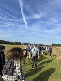
It was the perfect day last Sunday for Epping Forest’s Big Walk, a beautiful morning of clear skies as we set off across Wanstead Flats, gateway to the forest.
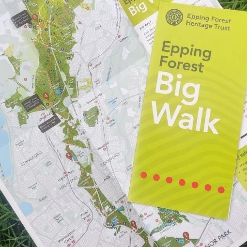
For nearly 50 years, since the centenary of the Epping Forest Act in 1978, people have met once a year to walk the length of the forest, from its southern-most extent in Manor Park in East London to its northern tip in the Essex district of Epping Forest. It’s a hike of some 14 miles or nearly 23km that makes the most of the present-day forest’s attenuated shape and takes you through a precious slither of wild, open pasture in the urban lower reaches, to the widening, deeper forest remains as you climb up a ridge into south-west Essex.
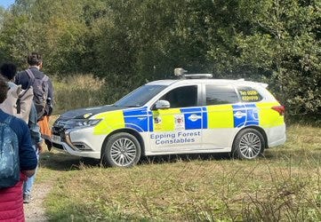
The day was brilliantly organised by the Epping Forest Heritage Trust, a charity that in recent years has gone from a low key, amateur enterprise to a well-run and increasingly impactful organisation under the direction of the retiring Chair, Judy Adams and CEO, Peter Lewis. We had the forest’s own constabulary holding back the traffic on the road crossings, volunteers providing tea and squash at well timed rest spots, excellent talks from local historians and conservation officials and an encouraging turnout from local MPs and the Corporation of London, which oversees the management the forest.
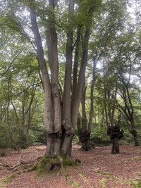
It was great to spend the day among people who share a love for and curiosity about the forest, and what better way to clock up over 30,000 steps than by revisiting some of my favourite places. For me, the highlight was the stretch along the Green Ride, through the preposterously oversized ancient Beech pollards of Great Monks Wood and past the atmospheric iron age settlement of Ambresbury Banks.
Walking as a political act
There is a point in the walk though that is not just pleasurable, but political. The small act of gathering together to walk as far as we can go across this ancient piece of land that was saved for us, is a way of re-asserting our rights to it. It evokes the perambulations that were used to the mark the forest boundaries from medieval times, or the ancient practice of beating the bounds to mark parish perimeters. Today more than ever, making use of our rights of way and ability to access common land remains an important way to demonstrate that we still value those rights and will protect them. What better place to demonstrate that, than in the forest which Oliver Rackham, the renowned landscape historian, associated with the birth of the conservation movement in the UK, when it was saved in 1878.
Neil Hudson, the recently elected Conservative MP for Epping Forest, joined us at the end of the walk and was proud to point out that 2024 marked the centenary of Winston Churchill’s election to that constituency covering the top part of the forest - one that he held throughout the war until 1945, before moving to the nearby constituency of Woodford, which also covers part of the forest. If only the present day Conservatives were as quick to remember the Liberal Churchill’s early hatred for the ‘evils of an unreformed and vicious land system’ and his support for land reform, the need to assert our rights to our vanishing areas of common land would be less pressing. I will come back to this in another newsletter.
Visiting Epping Forest
It is an irony that, while saved for the people, one of the greatest threats to the forest is the pressure of visitor numbers, and these continue to increase as the density of surrounding housing development intensifies. During the pandemic, many forest footpaths became so muddy as to be unusable; my children’s wellies were no match for the churned up clay soil. Yet the more people who visit and enjoy the forest, the more voices can be raised in support of its protection. During the walk, the Corporation of London officials and the Heritage Trust spoke about the work they are doing to facilitate people’s enjoyment of Epping Forest and the health benefits of spending time in nature, while also mitigating the impact of large numbers of visitors.
All visitors are encouraged to access the forest by foot, cycle or public transport. It is incredibly well-served by both train and bus; the Central underground line to Epping and the overground Weaver line to Chingford both have stops close to the forest. They are also encouraging visitors who live close by to enter the forest from their closest point, rather than travelling to High Beach, for example, which can get really over-crowded.
Maps & apps
I’ve posted a few maps below to give you a sense of Epping Forest’s location and geography. You can, of course, just rock up and have a wander. It is incredibly easy to get lost in its labyrinths, which is a wonderful thing I think, and not really a problem because you are never far from civilisation. However if your legs (or your children’s) will only last for a finite period, or if you want to start and end in predictable places, then you might want to follow one of the trails.
This section of the Corporation of London’s site provides maps for specific routes, and the Heritage Trust has recently brought out an app that opens up several more, and makes it very easy to follow where you are. You can also get an excellent physical map of the forest at the visitor centres in High Beach and next to the Queen Elizabeth Hunting Lodge in Chingford. The Heritage Trust and others also organise guided walks through the year.
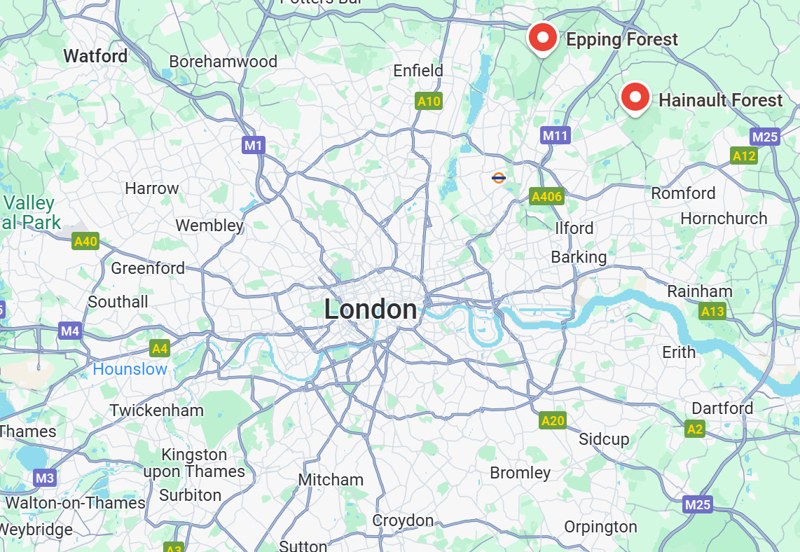
If you’re starting from scratch, this map shows where Epping and Hainault Forests are in relation to London.
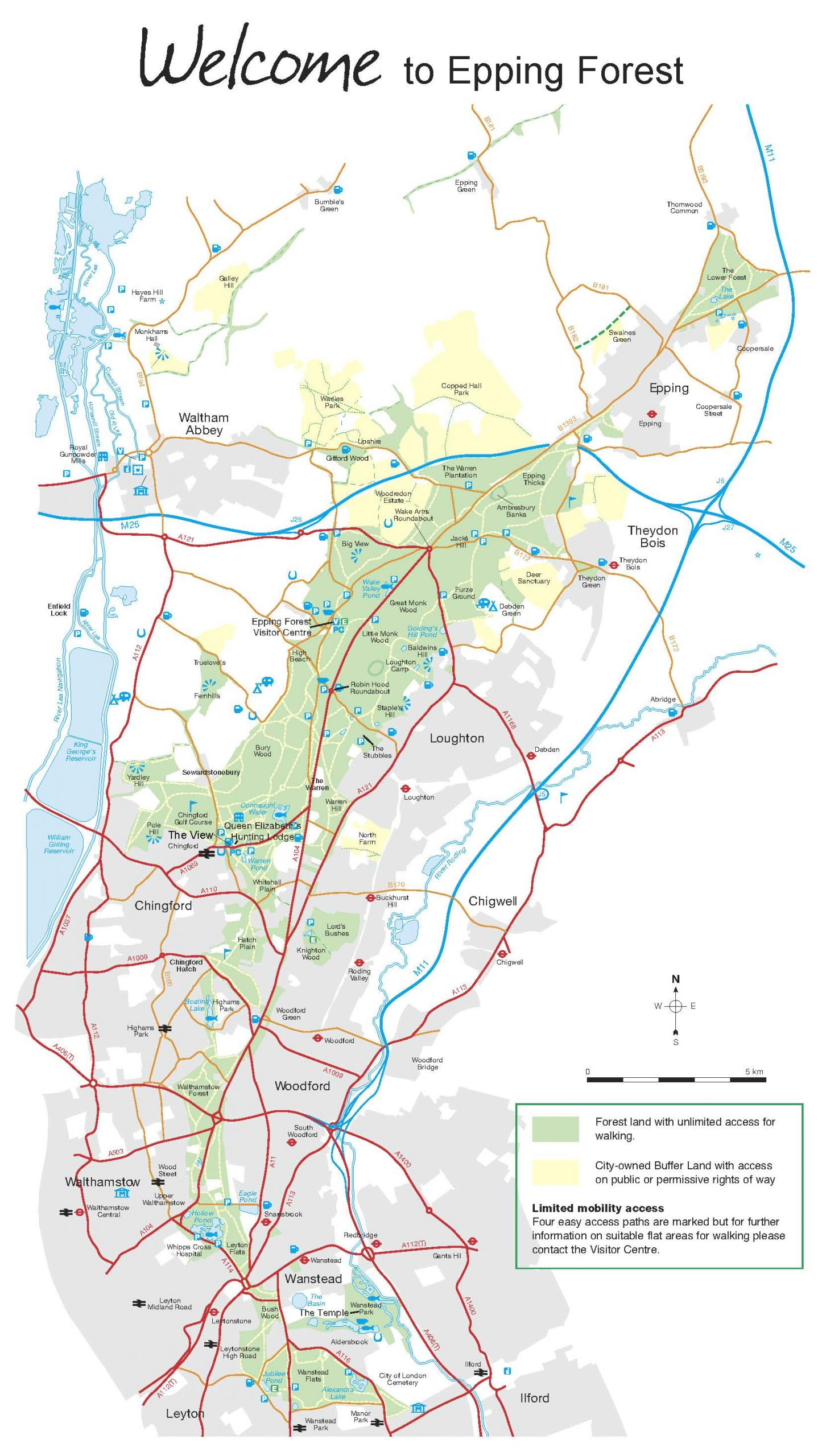
The Corporation of London map below shows Epping Forest’s present-day extent, which largely conforms to the boundaries set out in the 1878 Act, except that happily, some buffer lands have been added back to the forest over time, such as at Copped Hall and Warlies Park. You can see how tube stations follow the length of it, and also how it would once have been bounded by the Lea on the left and the Roding on the right.
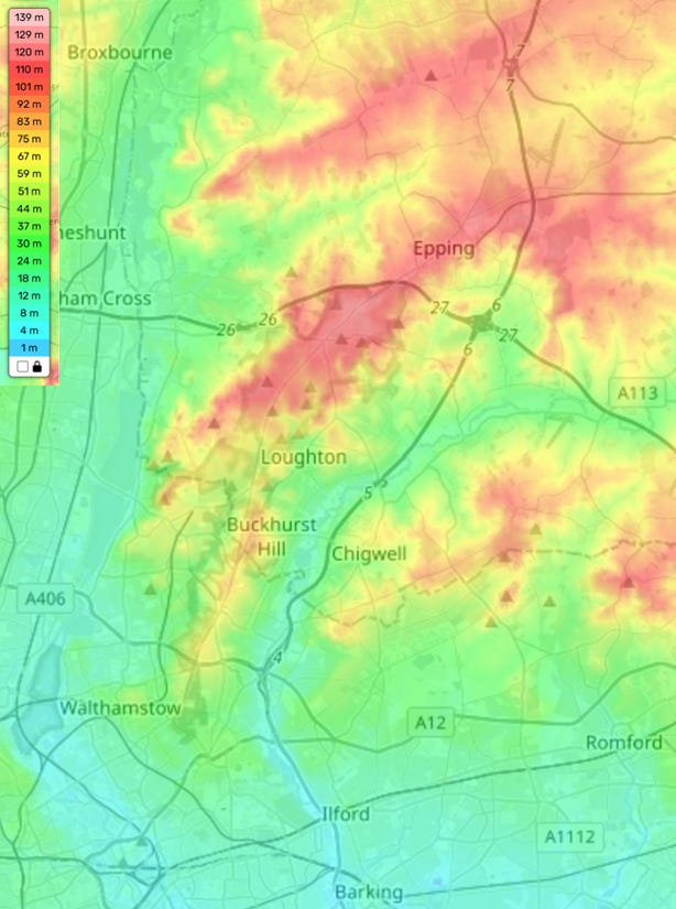
This topographical map below shows how Epping Forest rises from the lower-lying land nearer the Thames to the south and the marshes of the Lea to the East, and rises on a ridge to the north-east of London. There is no missing this fact on the Big Walk, as you hit the more challenging sections when you’re already quite tired in the afternoon! You can also see how the River Roding (between Buckhurst Hill and Chigwell on the map) makes a natural boundary between the Epping and Hainault parts of the forest.
Thank you for reading this newsletter. I’d love to know if you are already a regular visitor to Epping Forest? If so, which routes would you recommend? Or have I managed to persuade you to visit for the first time? If not yet, then read on, there is SO much more I want to tell you about it.


